
Product Line
All-scenario high-precision positioning products for diverse industry applications
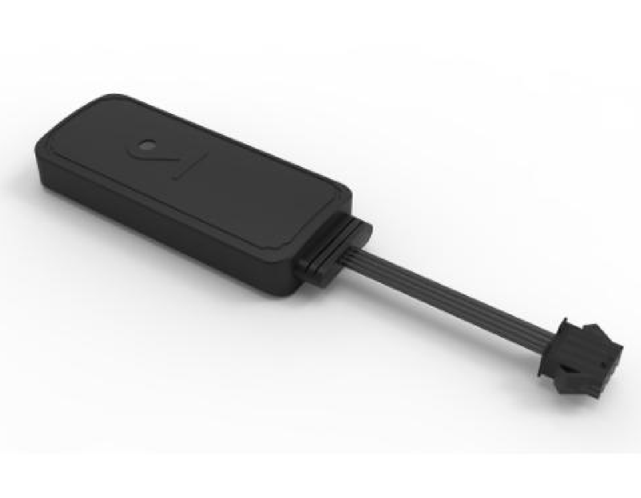
GT01 Vehicle Tracking Terminal
4G Full-Network Vehicle GPS Tracker with Multi-Mode Satellite Positioning for Fleet Management and Vehicle Monitoring
Core Features
- Supports multi-mode satellite positioning: BDS, GPS, Galileo, GLONASS, and QZSS
- 4G-CAT1 Global Network Communication
- Supports wide voltage input from 9 to 90V
- Supports OTA online remote updates
- Supports JT808 protocol reporting
- ACC Detection, Remote Fuel/Cutoff (Optional)
Technical Specifications
- Operating Voltage: DC 9V~90V
- Operating Current: ≤100mA@12V
- Positioning accuracy: Single-point 3-10m CEP, RTK < 10cm+1ppm
- Cold start time: average ≤ 30s
- Warm boot time: average ≤1s
- Operating Temperature: -20°C ~ 65°C
- Water Resistance Rating: IP67
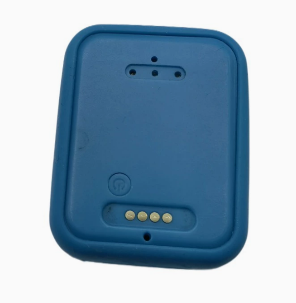
Pet Smart Tracker P1
Quad-mode satellite positioning, 4G full-network compatibility, and smart low-power design—precise tracking solutions built for pets.
Core Features
- Quad-mode satellite positioning: GPS, BD, GLONASS, and Galileo for global coverage
- 4G All-Network Communication, supports 12 bands
- Smart low-power mode with vibration-triggered auto wake-up
- Geofence alert, real-time location tracking
- History Playback and Activity Range Statistics
Technical Specifications
- Operating Voltage: DC 3.1V - 4.35V
- Charging Voltage: DC 5V
- Battery Capacity: 400mAh Polymer Lithium-Ion Battery
- Dimensions: 63.9 × 36.1 × 19.2 mm
- Weight: 34g (with battery)
- Positioning accuracy: < 10 meters (open environment)
- Operating Temperature: -25°C ~ +75°C
- Protection Rating: IP67, Waterproof and Dustproof
Communication Specifications
- Network Standards: 4G LTE-FDD/LTE-TDD
- Supported Bands: B1/B3/B5/B8/B34/B38/B39/B40/B41, etc. (12 bands)
- Data Transmission: TCP/UDP/MQTT Protocols
Use Cases
Daily pet safety tracking for cats, dogs, and more. Monitor your pet's location in real time via the mobile app, set up geofenced safe zones, and receive instant alerts for any unexpected movement.
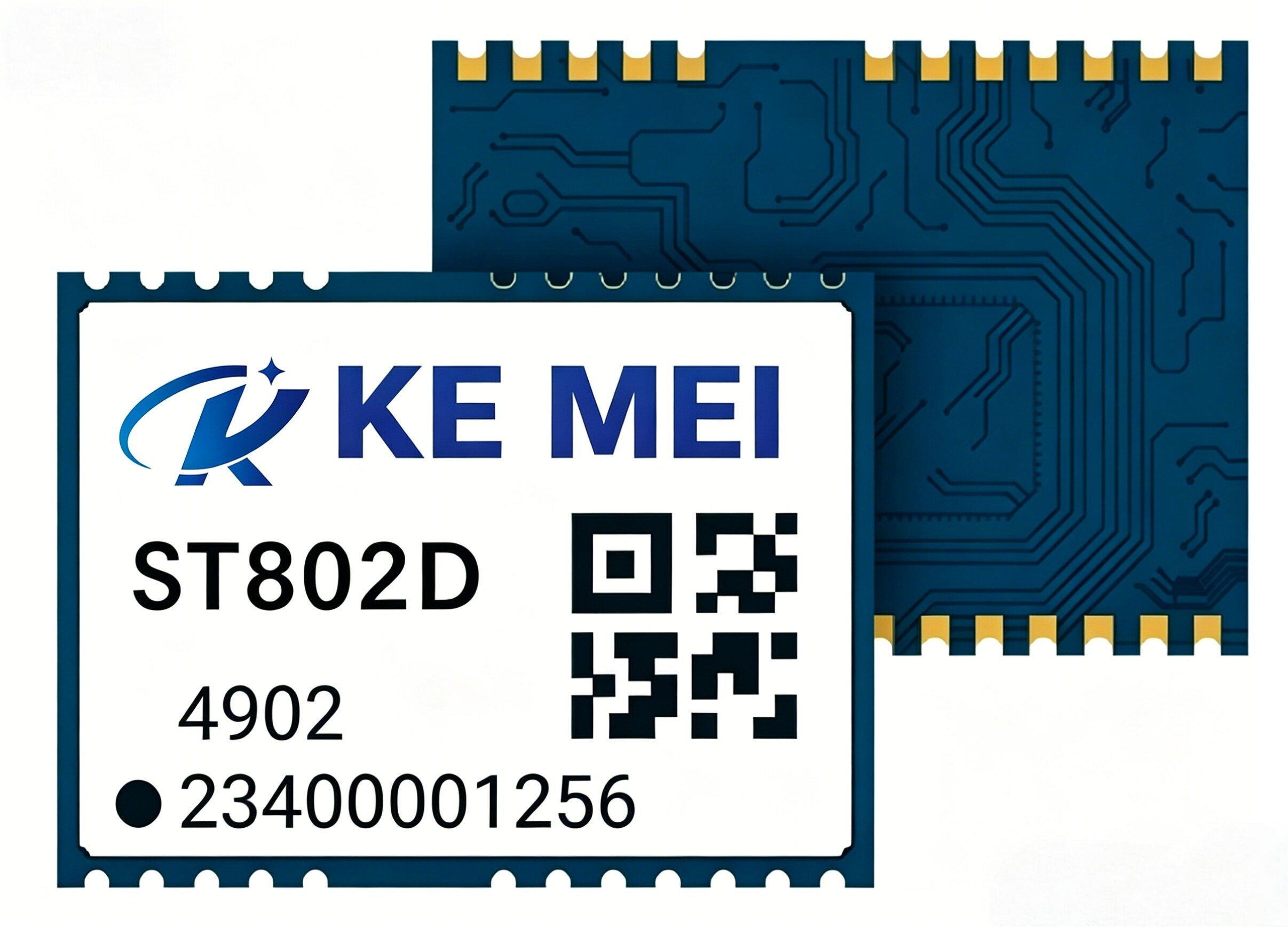
ST802D Multi-Frequency, Multi-Mode Submeter GNSS Module
L1/L5 dual-frequency receiver supporting BDS, GPS, GLONASS, GALILEO, and QZSS full constellation. Dimensions: 12.2 × 16.0 × 2.6 mm
Core Features
- L1+L5 dual-band reception with strong multipath interference resistance
- Supports five satellite systems: BDS, GPS, GLONASS, GALILEO, and QZSS.
- Built-in high-performance antenna for superior signal reception sensitivity.
- Supports A-GNSS-assisted positioning for fast first-time location acquisition.
Technical Specifications
- Dimensions: 12.2 × 16.0 × 2.6 mm
- Weight: < 2g
- Operating voltage: 3.3V ± 0.3V
- Power consumption: Continuous positioning < 30mA
- Positioning Accuracy: Sub-meter (Single-point positioning)
- Cold start time: < 35 seconds
- Warm start time: < 1 seconds
- Operating Temperature: -40°C ~ 85°C
Use Cases
Ideal for scenarios requiring miniaturized, high-precision positioning, such as drones, smart wearables, IoT devices, and vehicle navigation systems.

S109-G Handheld GPS Tracker
Handheld GPS tracker designed for lithium batteries in two-wheeled electric vehicles and mopeds, supporting BMS communication and data acquisition.
Core Features
Supports multi-mode satellite positioning: BDS, GPS, GALILEO, GLONASS, and QZSS
4G-CAT1 Full Network Communication
Communicate with the BMS protection board via UART to collect battery status data.
Supports OTA online remote upgrades and parameter configuration
Supports JT808 protocol with dual IP reporting
Built-in 3D gyroscope with vibration detection and anti-theft alarm support
Waterproof O-ring design
GPS + Beidou High-Precision Positioning
Supports all industry BMS protocols; custom development available
Provide a dedicated cloud platform after-sales account
Technical Specifications
Operating Voltage: DC 9V~90V (Typical: 12V)
Operating Current: 12V / Average 35mA
Standby current: ≤10mA
Positioning accuracy: Single-point 1.5m CEP (horizontal)
Cold start time: average ≤ 30s
Cold start time: average ≤3s
Tracking sensitivity: -165dBm
Operating Temperature: -30°C ~ 85°C
Enclosure dimensions: 105 × 57 × 18.5mm
Application Areas
Scenarios for 2- and 3-wheeled electric vehicles, electric motorcycles, and managed rental lithium batteries
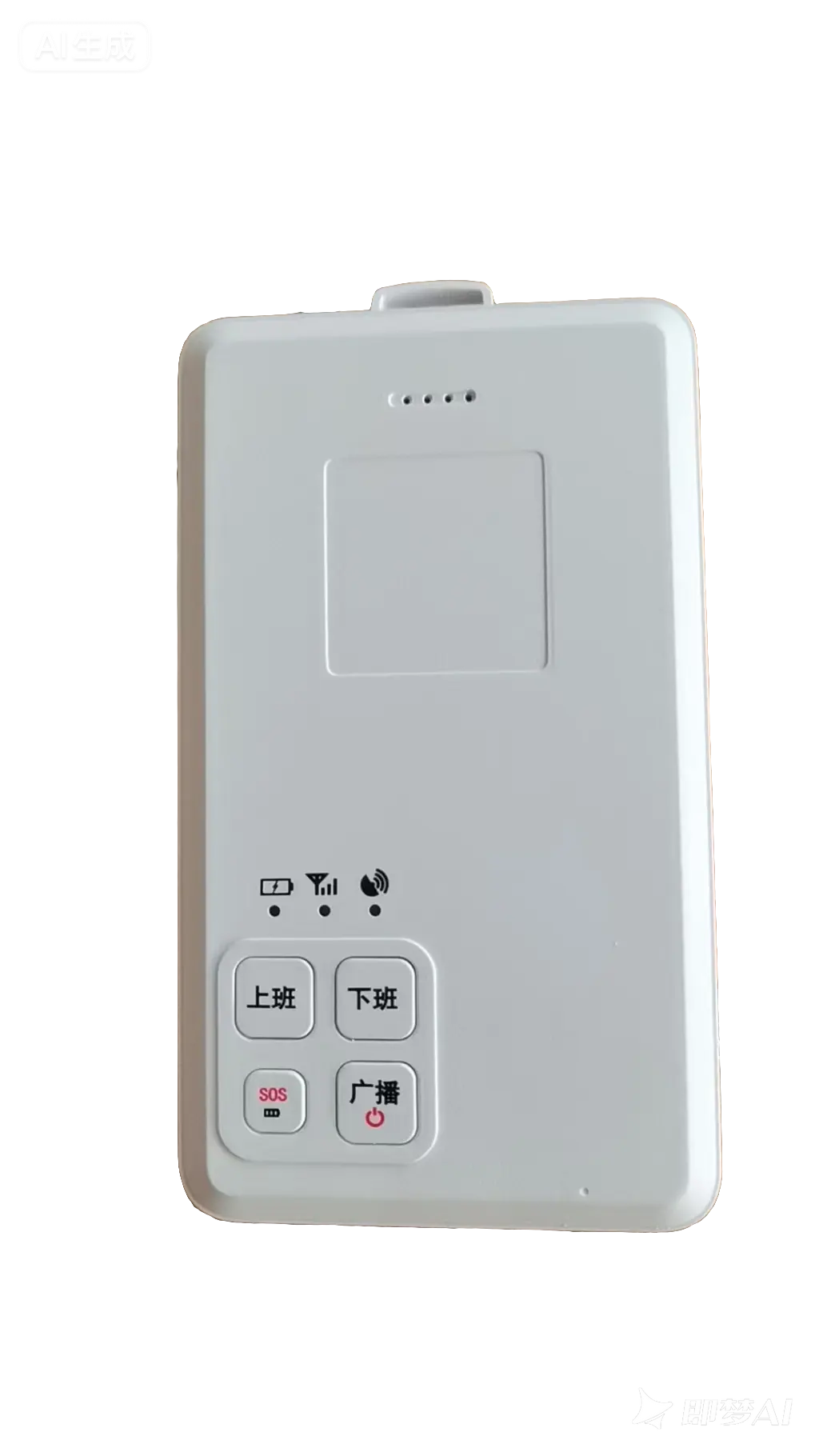
S30 Smart Badge
Indoor-outdoor multi-assisted positioning supports BDS/GPS/Galileo/GLONASS/QZSS + Bluetooth/WiFi/UWB. Features 4G-CAT1 global network compatibility, one-touch SOS emergency call, TTS voice announcements, IP67 water resistance rating, and long-lasting battery life with a 2000mAh mAh battery.
Product Overview
S30 Smart Badge is an intelligent terminal designed for personnel tracking and safety management. It combines indoor and outdoor positioning technologies, supports multiple satellite navigation systems and wireless positioning methods to deliver high-precision, reliable location tracking.
Core Features
- Multi-mode Satellite Positioning: Supports five satellite navigation systems: BDS (BeiDou), GPS, Galileo, GLONASS, and QZSS
- Indoor Assisted Positioning: Supports multiple indoor positioning technologies including Bluetooth, WiFi, and UWB
- 4G-CAT1 Global Network: Supports full-band coverage for China Mobile, China Unicom, and China Telecom
- One-Touch SOSQuickly trigger alarms in emergencies to ensure personnel safety
- TTS Voice Announcement: Supports text-to-speech with real-time announcements for critical information
- Long-lasting battery: Built-in 2000mAh high-capacity battery for extended work sessions
- IP7 Water Resistance Rating: Dustproof and waterproof design for harsh environments
Technical Specifications
| Size | 106.8 × 61.9 × 12 mm |
| Outdoor positioning accuracy | 1.5m CEP (Single Point Positioning) |
| Operating Temperature | -20℃ ~ 60℃ |
| Charging method | Magnetic contact charging DC 5V@1A |
| Battery Capacity | 200 mAh |
| Protection Rating | IP67 |
Use Cases
- Personnel Location Management in Petrochemical Industrial Zones
- Safety Monitoring for Tunnel and Utility Tunnel Construction
- Power Plant Maintenance Operation Management
- Smart Park Personnel Dispatch
- Open-pit mine personnel positioning
- Shipyard Personnel Safety Management
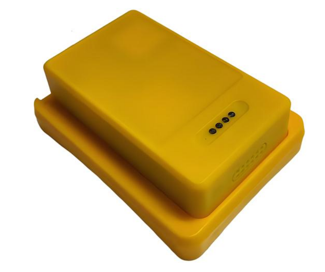
TK01 Hard Hat Positioning Tag
Indoor-outdoor hybrid multi-assisted positioning supporting BDS/GPS/Galileo/GLONASS/QZSS + Bluetooth/WiFi indoor location, 4G-CAT1 full-network compatibility, TTS voice announcements, IP67 water resistance rating, and 1200mAh battery.
Product Overview
The TK01 Series Safety Helmet Location Tag is a wearable positioning device designed for personnel management, widely used in mines, construction sites, and other locations. It employs integrated indoor-outdoor multi-assisted positioning technology to ensure precise and accurate location tracking for personnel both indoors and outdoors.
Core Features
- Indoor-Outdoor Integrated Positioning: Outdoor BDS+GPS+Galileo+GLONASS+QZSS combined differential positioning + indoor Bluetooth positioning fusion + WiFi scan positioning fusion
- 4G-CAT1 Global Network: Supports coverage from China Telecom, China Mobile, and China Unicom
- TTS Voice Announcement: The platform can directly send voice commands to the work card.
- One-Touch SOS: Send emergency call to preset number to ensure personnel safety
- Long-lasting battery: Equipped with a 1200mAh high-capacity rechargeable battery
- IP7 Water Resistance Rating: Designed for harsh environments
Technical Specifications
| Size | 66.5 × 44 × 16 mm (label body) |
| Casing Material | ABS |
| Operating Temperature | -20℃ ~ 70℃ |
| Charging method | Magnetic contact charging DC 5V@1A |
| Battery Capacity | 120 mAh |
| Protection Rating | IP67 |
Use Cases
- Mine Personnel Location Management
- Construction Site Personnel Safety Management
- Personnel Tracking in Petrochemical Industrial Zones
- Tunnel Construction Safety Monitoring
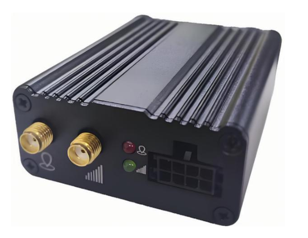
S15 High-Precision Positioning Terminal
Dual-band, full-constellation RTK centimeter-level positioning terminal with built-in high-performance IMU for high-precision vehicle positioning.
Core Features
- Full-band, multi-constellation RTK centimeter-level positioning
- 5-Mode Positioning: BDS, GPS, GLONASS, Galileo, QZSS
- Built-in high-performance IMU inertial navigation system
- 4G-CAT1 Wireless Communication
- Support CORS differential data ingestion
- LEMO connector ensures stable data transmission.
Technical Specifications
- Positioning accuracy: RTK horizontal 0.8cm+1ppm, vertical 1.5cm+1ppm
- Heading accuracy: 0.1 degrees/1m baseline
- First location time: Cold start < 30s, Hot start < 1s
- Operating temperature: -35°C to +70°C
- Dimensions: 128×79×50mm
- Weight: 435g

S109-TR Square GPS Tracker
Square GPS tracking terminal designed for two-wheeled electric vehicles, e-motorcycles, and energy storage lithium batteries; supports BMS communication.
Core Features
Supports multi-mode satellite positioning: BDS, GPS, GALILEO, GLONASS, and QZSS
4G-CAT1 Full Network Communication
Supports wide voltage input from 9 to 90V
Communicate with the BMS protection board via UART to collect battery status data.
Supports OTA online remote upgrades and parameter configuration
SMS feature configuration and device maintenance
Supports JT808 protocol; reports positioning results via dual IP.
Built-in 3D gyroscope for real-time motion tracking
Waterproof O-ring design
GPS + Beidou High-Precision Positioning
Supports all industry BMS protocols; custom development available
Provide a dedicated cloud platform after-sales account
Technical Specifications
Operating Voltage: DC 9V~90V (Typical: 12V)
Operating Current: 12V / Average 35mA
Standby current: ≤10mA
Positioning accuracy: Single-point 1.5m CEP (horizontal)
Cold start time: average ≤ 30s
Cold start time: average ≤3s
Tracking sensitivity: -165dBm
Operating Temperature: -30°C ~ 85°C
Enclosure dimensions: 105 × 57 × 18.5mm
Application Areas
Scenarios for 2- and 3-wheel electric vehicles, electric motorcycles, energy storage lithium battery management, and rental lithium battery management
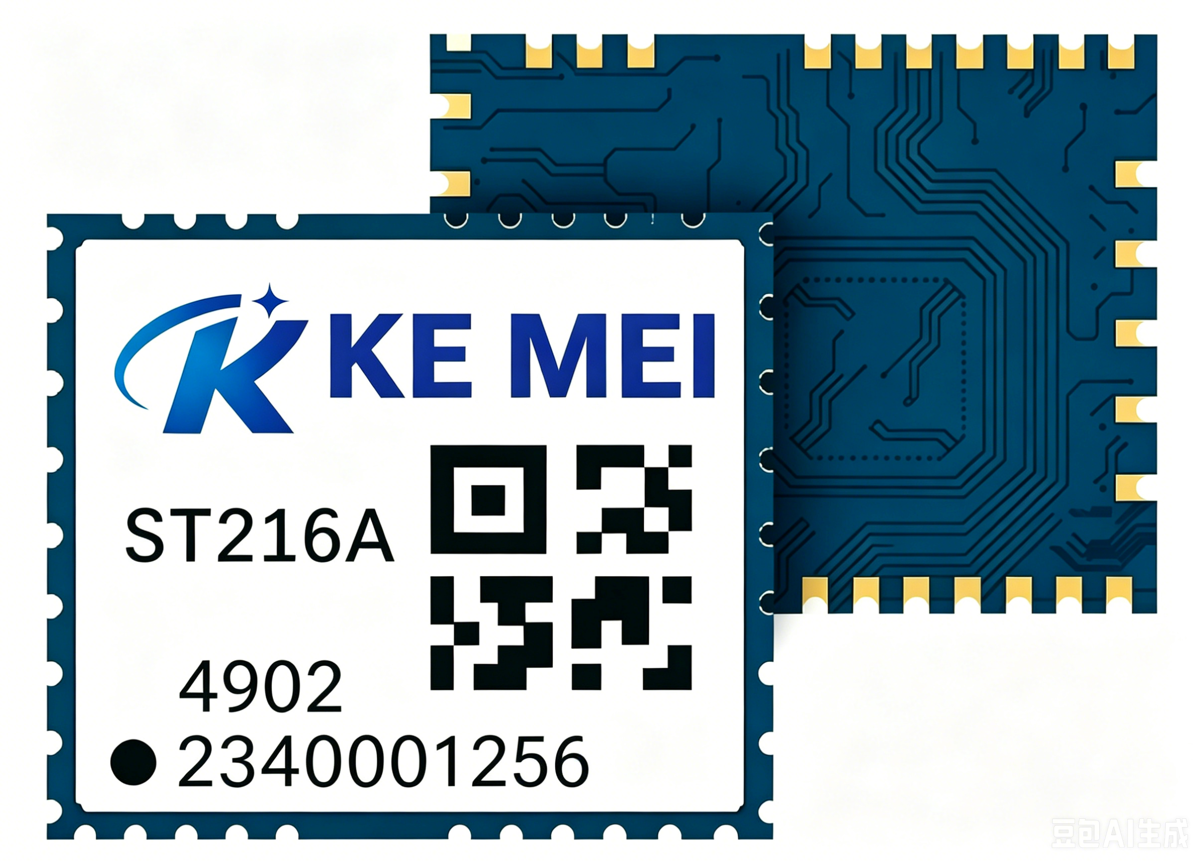
ST216A Single-Frequency Quad-Constellation GNSS Module
Supports BDS, GPS, GLONASS, GALILEO, and QZSS five-system GNSS. Compact size: 16.0×12.2×2.4mm. High cost-performance solution.
Core Features
- Single-frequency L1 receiver supporting five major satellite systems
- High-sensitivity design delivers superior performance in low-signal environments.
- Built-in TCXO with excellent frequency stability
- Supports SBAS (Satellite-Based Augmentation System)
Technical Specifications
- Dimensions: 16.0 × 12.2 × 2.4 mm
- Weight: < 2g
- Operating voltage: 3.3V ± 0.3V
- Power consumption: Continuous positioning < 25mA
- Positioning Accuracy: 2.5m CEP (Single Point Positioning)
- Cold start time: < 30 seconds
- Warm start time: < 1 seconds
- Operating Temperature: -40°C ~ 85°C
Use Cases
Ideal for cost-sensitive, large-scale deployments such as shared bikes, logistics tracking, asset monitoring, and personnel location.
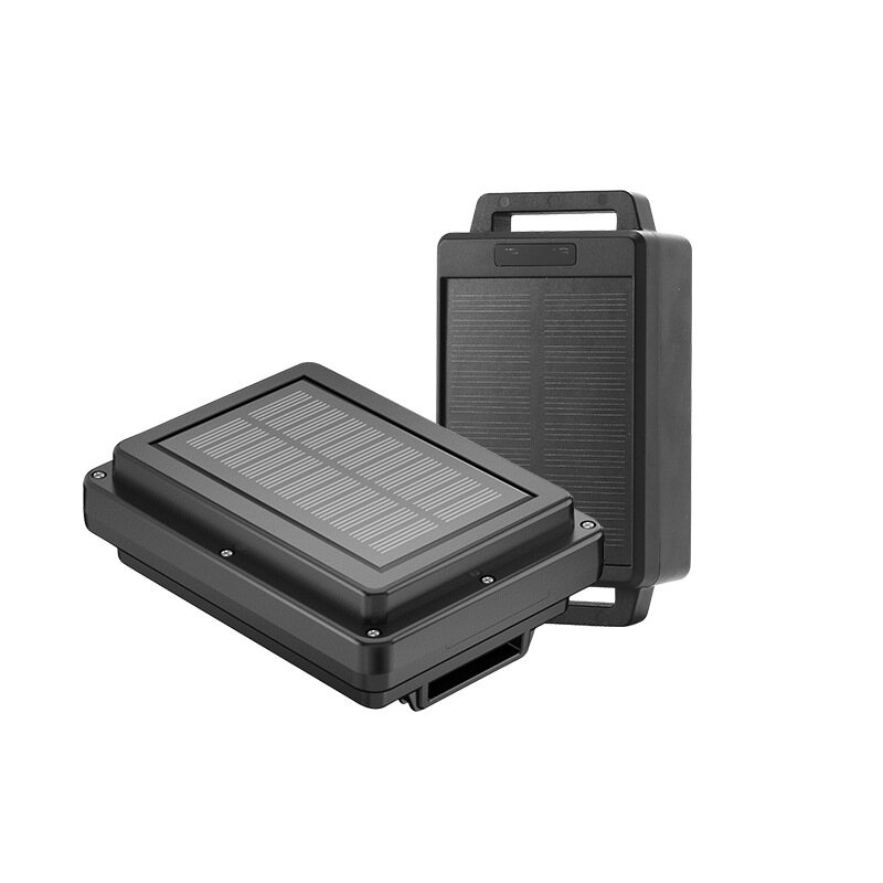
Smart Livestock Tracker L1 for Cattle and Sheep
Multi-mode positioning + solar charging for ultra-long battery life. Industrial-grade GPS tracker designed specifically for livestock management on ranches.
Core Features
- Multi-Mode Fusion Positioning: GPS + BeiDou + Wi-Fi + LBS
- Solar-assisted charging for extended battery life
- Low-battery smart alert prevents device disconnection
- Geofence Management: Instant Alerts for Boundary Breaches
- Multi-platform monitoring with support for web and mobile.
- Group Management: View Livestock Locations in Batch
Technical Specifications
- Location Mode: GPS + BeiDou + Wi-Fi + LBS
- GPS accuracy: 3~10 meters
- Base station location accuracy: 100~1000 meters
- Standby current: < 0.5mA (minimum), < 3.9mA (average)
- Operating Current: Approximately 60mA
- Battery Options: 5000/10000/20000mAh Polymer Battery
- Operating Temperature: -20°C ~ +70°C
- Protection Rating: IP68, Waterproof and Dustproof
Key Features
- Solar charging panel extends outdoor usage time
- Multi-alarm mechanism: low battery, geofence breach, and idle timeout
- Supports large-scale deployment; manage tens of thousands of livestock on a single platform.
- Rugged, durable housing built for harsh ranch environments
Use Cases
Pasture management for large livestock such as cattle and sheep. Enables grazing monitoring, anti-theft alerts, and health tracking to significantly boost operational efficiency.
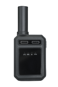
S21 High-Precision Positioning Terminal
Dual-band RTK centimeter-level positioning with multi-constellation support (GPS, BDS, Galileo, QZSS). 4G full-network connectivity. Built-in sensors for intelligent power saving. Ideal for surveying, exploration, and deformation monitoring.
Product Overview
S21 is a high-precision mobile positioning terminal powered by 4G. It integrates 4G wireless communication with GPS/BDS satellite navigation and leverages our proprietary BeiDou differential positioning and combined navigation technologies to ensure accuracy in any environment.
Core Features
- Centimeter-level high-precision positioning: RTK horizontal accuracy 1cm + 1ppm, vertical accuracy 2cm + 1ppm
- Multi-system, multi-frequency: Supports BDS B1I/B2a, GPS L1/L5, Galileo E1/E5a, and QZSS L1/L5
- 4G LTE Full Network Compatibility: Supports FDD/TDD full bands; max downlink rate 10 Mbps
- Quick Initialize: Cold start < 30s, Warm start < 1s, Fixed solution convergence time ≤ 10s
- Smart Power Saving: Built-in accelerometer for intelligent power-saving wake-up
- Flexible fitHandheld, mountable on hard hats, or wearable on the chest or arm
Technical Specifications
| Host Dimensions | 57 × 22 × 140 mm |
| GNSS antenna | 19 × 19 × 50 mm |
| Casing Material | ABS Plastic |
| Operating Temperature | -20℃ ~ 75℃ |
| Battery Capacity | 2500mAh (3.7V Polymer Battery) |
| Working Hours | 12+ hours |
| Charging method | Magnetic Contact Charging DC 5V/500mA |
Use Cases
- Surveying and Exploration
- Deformation Monitoring
- Precision Agriculture
- Drone Navigation
- Bridge and Tunnel Monitoring
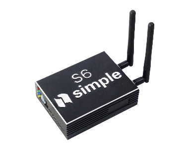
S6 In-Vehicle GPS Tracker
Industrial-grade vehicle GPS tracker with multi-mode satellite positioning and 4G connectivity, designed for managing construction and commercial vehicles.
Core Features
- Supports multi-constellation positioning: BDS, GPS, Galileo, and GLONASS
- 4G All-Network Communication
- Supports wide voltage input from 9 to 90V
- Built-in 3-axis accelerometer
- Supports ACC detection and power-off alarm
- Supports remote configuration and OTA updates
Technical Specifications
- Operating Voltage: DC 9V~90V
- Positioning Accuracy: Single-point 3-10m CEP
- Cold start time: average ≤ 30s
- Operating Temperature: -20°C ~ 65°C
- Water Resistance Rating: IP67
- Housing Material: ABS Plastic
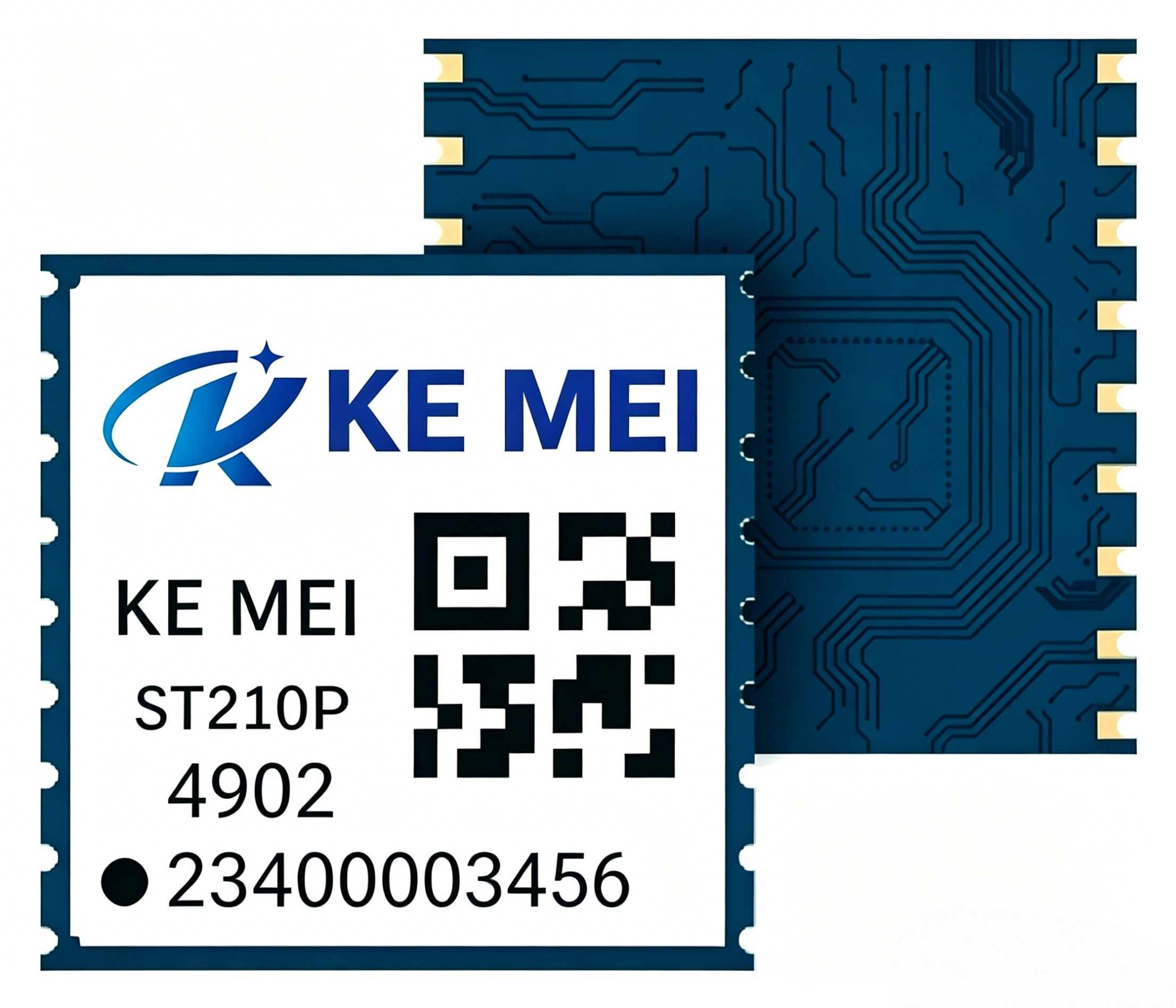
ST210P Dual-Band RTK Positioning Module
L1+L5 dual-band RTK for centimeter-level positioning. Ultra-compact, high-precision solution with dimensions 10.1×9.7×2.2mm.
Core Features
- L1+L5 dual-frequency RTK technology delivers centimeter-level positioning accuracy.
- Supports BDS, GPS, GLONASS, GALILEO, and QZSS full constellation
- Built-in high-performance INS algorithm supports extended operation during brief signal loss.
- Fast RTK initialization, averaging under 10 seconds
Technical Specifications
- Dimensions: 10.1 × 9.7 × 2.2 mm
- Weight: < 1.5g
- Operating voltage: 3.3V ± 0.3V
- Power consumption: RTK mode < 50mA
- Positioning Accuracy: Horizontal 1cm + 1ppm, Vertical 2cm + 1ppm
- RTK Initialization Time: < 10 seconds
- Data update rate: up to 20Hz
- Operating Temperature: -40°C ~ 85°C
Use Cases
Designed for professional applications requiring centimeter-level accuracy, including surveying instruments, drone-based precision agriculture, robot navigation, and autonomous driving.
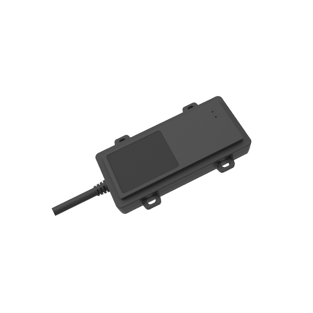
S109A-G Long-Shape GPS Tracker
Compact, elongated GPS tracker designed specifically for lithium batteries in two-wheeled electric vehicles and e-motorcycles. Sleek design enables discreet, hidden installation.
Core Features
Supports multi-mode satellite positioning: BDS, GPS, GALILEO, GLONASS, and QZSS
4G-CAT1 Full Network Communication
Communicate with the BMS protection board via UART to collect battery status and data.
Supports OTA online remote upgrades and parameter configuration
Enable SMS configuration for device maintenance
Supports JT808 protocol; reports positioning results and status data via dual IPs.
Built-in 3D gyroscope with vibration detection and anti-theft functionality
Waterproof O-ring design
GPS + Beidou High-Precision Positioning
Supports all industry BMS protocols; custom development available
Provide a dedicated cloud platform after-sales account
Technical Specifications
Operating Voltage: DC 9V~90V (Typical: 12V)
Operating Current: 12V / Average 35mA
Standby current: ≤10mA
Positioning accuracy: Single-point 1.5m CEP (horizontal)
Cold start time: average ≤ 30s
Cold start time: average ≤3s
Tracking sensitivity: -165dBm
Operating Temperature: -30°C ~ 85°C
PCBA dimensions: 66.80×27×17mm
Enclosure dimensions: 105 × 57 × 18.5mm
Application Areas
Ideal for concealed installations in scenarios such as two- and three-wheeled electric vehicles, electric motorcycles, and rental lithium battery management.
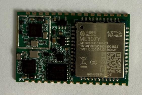
S109M Positioning Module
A stamp-hole positioning module integrating 4G, GPS, and Bluetooth offers a new option for designing compact products.
Core Features
Built-in 4G communication module
Integrate GPS positioning
Integrate Bluetooth communication
Integrate G-sensor accelerometer
Integrated SIM (iSIM)
Uses 32-pin stamp hole package
New options for designing compact products for customers
Technical Specifications
Module dimensions: 35×22×3.2mm
Mounting style: 32-pin postage stamp hole
4G Antenna Interface: 50Ω Impedance
GPS antenna interface: 50Ω impedance
BLE Antenna Interface: Dedicated Connector
Serial communication: 1.8V TTL levels
Power output: VBAT 3.8V/2A
GPIO Output: 1.8V TTL Level
Application Areas
Ideal for positioning products requiring high integration and miniaturization, such as smart wearables, IoT endpoints, and portable trackers.
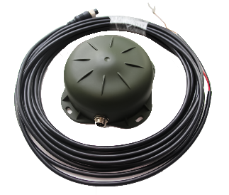
S12 Vehicle GPS Tracker
Compact vehicle tracking terminal with multi-mode satellite positioning for passenger car and new energy vehicle fleet management
Core Features
- Supports multi-mode positioning with BDS, GPS, Galileo, GLONASS, and QZSS
- 4G-CAT1 Global Network
- Supports 9-24V wide voltage input
- Built-in smart algorithm and accelerometer
- Supports JT808 protocol reporting
- SMS configuration and maintenance
Technical Specifications
- Operating Voltage: DC 9V~24V
- Operating Current: ≤100mA@12V
- Positioning Accuracy: Single-point 3-10m CEP
- Cold start time: average ≤ 30s
- Operating Temperature: -20°C ~ 65°C
- Water Resistance Rating: IP65
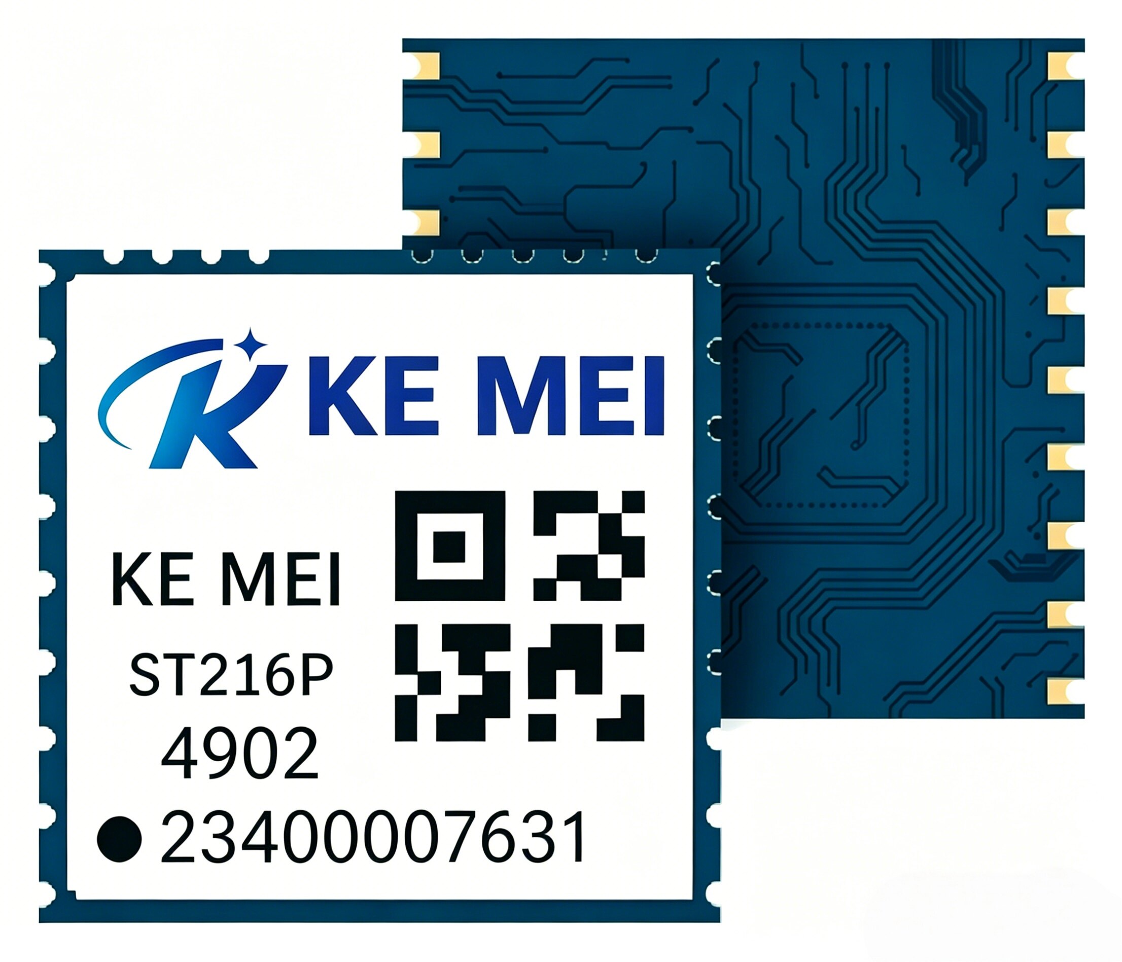
ST216P Dual-Band RTK Positioning Module
L1+L5 dual-band RTK for centimeter-level positioning. Dimensions: 16.0×12.2×2.4mm. Standard high-precision solution.
Core Features
- L1+L5 dual-band RTK technology for centimeter-level positioning accuracy
- Supports full-constellation reception across all five major satellite systems
- Built-in multi-path suppression algorithm with strong adaptability in complex environments
- Supports multiple output protocols including NMEA and UBX
Technical Specifications
- Dimensions: 16.0 × 12.2 × 2.4 mm
- Weight: < 2g
- Operating voltage: 3.3V ± 0.3V
- Power Consumption: RTK mode < 55mA
- Positioning Accuracy: Horizontal 1cm + 1ppm, Vertical 2cm + 1ppm
- RTK Initialization Time: < 15 seconds
- Data update rate: up to 20Hz
- Operating Temperature: -40°C ~ 85°C
Use Cases
Designed for industrial-grade high-precision positioning in surveying equipment, precision agriculture machinery, construction automation, and smart ports.
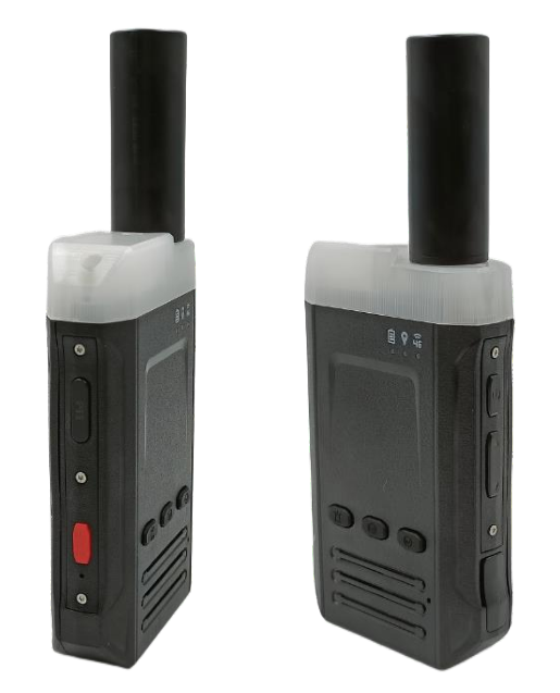
S20 4G High-Precision Positioning Two-Way Radio
Dual-band RTK centimeter-level positioning with public network push-to-talk. Flashing strobe light alerts nearby personnel. IP67 waterproof rating. Ideal for sanitation workers, highway patrol, and railway inspection scenarios.
Product Overview
The S20 is a high-precision 4G two-way radio terminal that integrates 4G wireless communication with GPS/BDS satellite navigation. It features an optional soft radio function supporting nationwide dispatch, one-to-one calls, and one-to-many group calls with multi-group switching. Equipped with a strobe warning light to alert nearby personnel.
Core Features
- Centimeter-level high-precision positioning: RTK horizontal accuracy 1cm + 1ppm, single-point positioning horizontal < 1.5m CEP
- Public Network Walkie-Talkie: Supports nationwide intercom, one-to-one calls, one-to-many group calls, and multi-group switching (optional)
- Flashing Warning Light: Alternating red and blue flash, 1W LED × 2, alerts nearby personnel
- Multi-system, multi-frequency: Supports GPS/QZSS L1C/A/L5, BDS B1/B2A/B2B/B2l, Galileo E1/E5, and GLONASS G1
- One-Tap SOSQuickly trigger an alarm in emergencies
- IP7 Water Resistance Rating: Built for harsh outdoor environments
Technical Specifications
| Overall Dimensions | 151.8 × 60.2 × 32.2 mm |
| Total Weight | 145g |
| Casing Material | ABS |
| Operating Temperature | -20℃ ~ 75℃ |
| Battery Capacity | 2500mAh (3.7V Polymer Battery) |
| Charging method | Type-C Charging DC 5V/500mA |
| Protection Rating | IP67 |
Use Cases
- Sanitation Worker Operations Management
- Highway Patrol Personnel Location
- Rail Patrol Personnel Tracking
- Municipal Facility Inspection
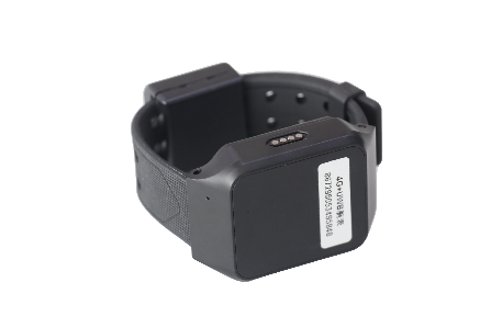
S50 Beidou GPS Wristband
4G CAT1 Mobile Positioning Terminal with BDS Satellite GPS, TTS Voice Announcements, Geofencing, Offline Data Storage & Retry Transmission. Ideal for locating elderly and children, managing field staff, and more.
Product Overview
The S50 is a 4G mobile positioning terminal that integrates 4G wireless communication technology with BDS satellite navigation. Featuring an industrial-grade, fully integrated internal antenna design, the device includes a 3-axis sensor and supports intelligent power-saving wake-up functionality.
Core Features
- BDS Satellite Positioning: Supports BeiDou B1 frequency; horizontal positioning accuracy < 3m
- 4G CAT1 Full Network Compatibility: Supports FDD/TDD full bands; includes built-in NANO-SIM card
- TTS Voice Announcement: Built-in speaker for intelligent voice announcements of electronic fence alerts and device status
- Geofence: Set safety zones for automatic alerts when entering or exiting the geofence
- Offline Data ResyncStores data in FLASH when signal is weak; automatically resends once signal is restored to ensure no data loss.
- Remote Management: Supports remote FOTA firmware updates, remote configuration, and real-time monitoring
Technical Specifications
| Host Dimensions | 60 × 43 × 20 mm |
| Casing Material | ABS Plastic |
| Operating Temperature | -20℃ ~ 75℃ |
| Battery Capacity | 500mAh (3.7V Polymer Battery) |
| Charging method | DC 5V/400mA |
| Location Accuracy | Horizontal < 3m |
Use Cases
- Child and Elderly Safety Tracking
- Field Staff Management
- Guardianship for Special Needs Individuals
- Campus Student Location Management
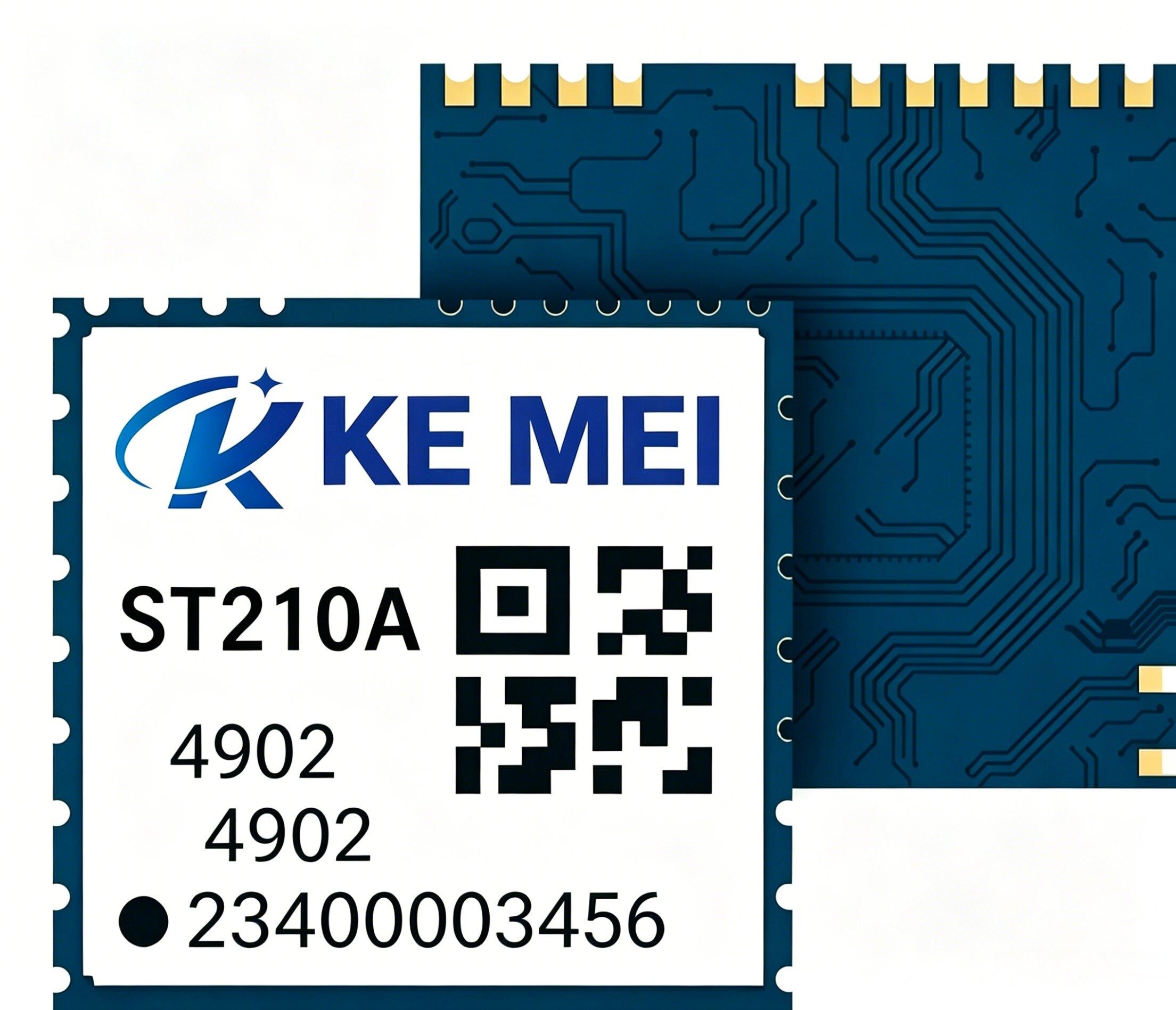
ST210A Single-Frequency Quad-System Positioning Module
Supports BDS/GPS/GLONASS/GALILEO/QZSS; size 10.1×9.7×2.2 mm. Ultra-compact, cost-effective solution.
Core Features
- Single-frequency L1 receiver supporting five major satellite systems
- Ultra-small package for space-constrained applications
- High-sensitivity design for urban canyon environments
- Low-power design for battery-powered devices
Technical Specifications
- Dimensions: 10.1 × 9.7 × 2.2 mm
- Weight: < 1.5g
- Operating voltage: 3.3V ± 0.3V
- Power consumption: Continuous positioning < 20mA
- Positioning Accuracy: 2.5m CEP (Single Point Positioning)
- Cold start time: < 32 seconds
- Warm start time: < 1 seconds
- Operating Temperature: -40°C ~ 85°C
Use Cases
Ideal for smartwatches, children's trackers, pet trackers, and small IoT devices where size and power consumption are critical.
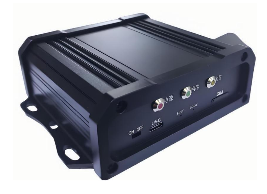
S9 In-Vehicle GPS Tracker
Multi-functional vehicle GPS tracker with multi-mode satellite positioning and rich peripheral interfaces, designed for complex fleet management scenarios.
Core Features
- Supports multi-mode positioning with BDS, GPS, Galileo, GLONASS, and QZSS
- 4G-CAT1 Global Network
- Supports wide voltage input from 9 to 90V
- Rich external APIs for integrating multiple sensors
- Supports ACC detection, power-off alert, and SOS alarm
- Remote fuel/power cutoff (optional)
Technical Specifications
- Operating Voltage: DC 9V~90V
- Positioning accuracy: Single-point 3-10m CEP, RTK < 10cm+1ppm
- Cold start time: average ≤ 30s
- Operating Temperature: -20°C ~ 65°C
- Water Resistance Rating: IP67
- Supports RS232/RS485 interfaces
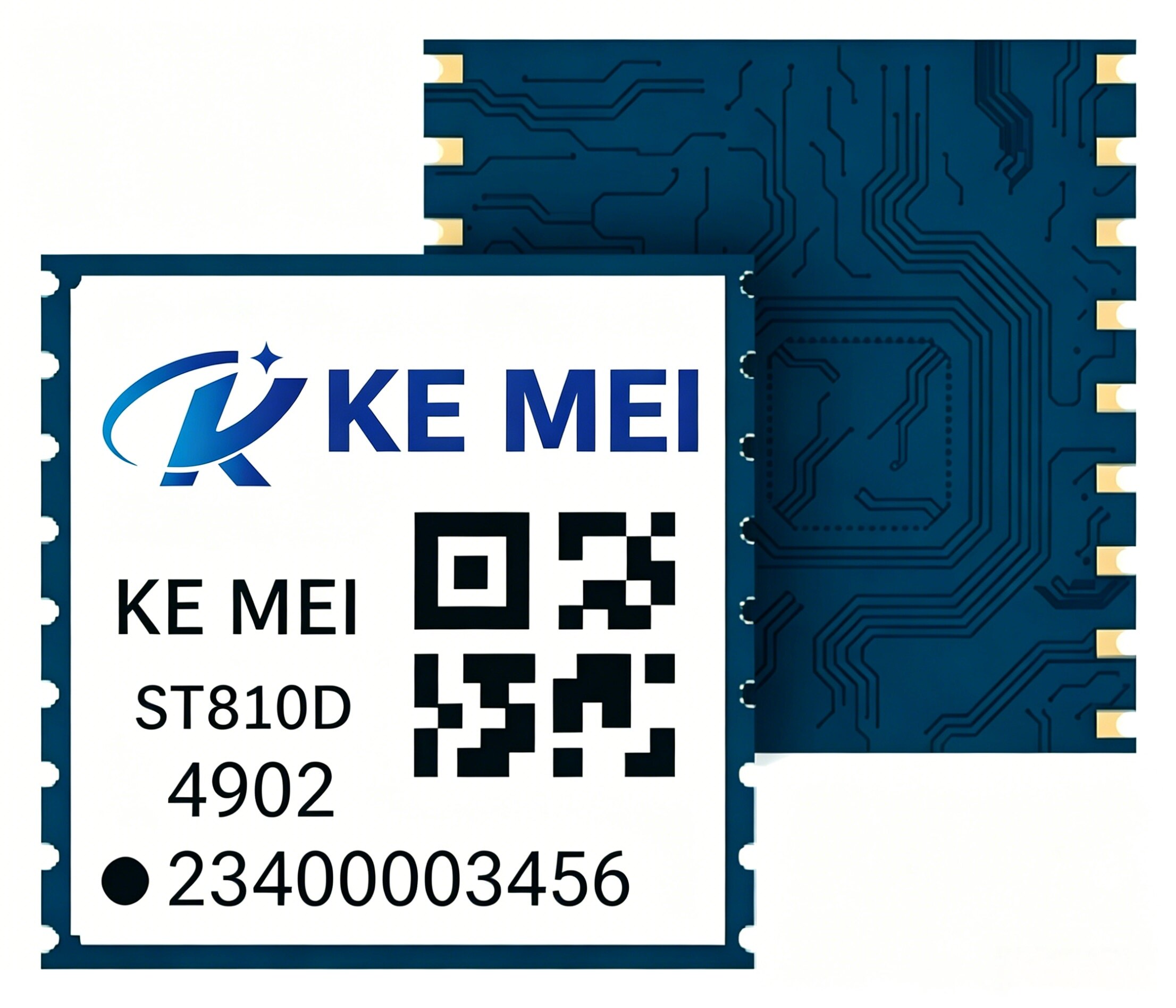
ST810D Dual-Band Submeter Positioning Module
L1+L5 dual-band reception with sub-meter positioning accuracy. Compact dual-band solution measuring 10.1×9.7×2.2mm.
Core Features
- L1+L5 dual-frequency reception effectively mitigates ionospheric errors.
- Supports all constellations across five satellite systems
- Built-in anti-interference algorithm for stable performance in complex electromagnetic environments.
- Supports A-GNSS for faster time-to-first-fix
Technical Specifications
- Dimensions: 10.1 × 9.7 × 2.2 mm
- Weight: < 1.5g
- Operating voltage: 3.3V ± 0.3V
- Power consumption: Continuous positioning < 35mA
- Positioning Accuracy: Sub-meter (Dual-frequency single-point positioning)
- Cold start time: < 35 seconds
- Warm start time: < 1 seconds
- Operating Temperature: -40°C ~ 85°C
Use Cases
Ideal for ride-sharing, logistics delivery, field management, and asset tracking—scenarios requiring better-than-standard GPS accuracy without needing RTK.
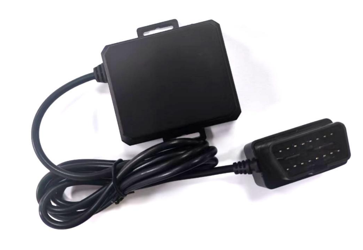
GT05 Vehicle Tracking Terminal
OBD port vehicle smart terminal, designed for passenger vehicles and new energy fleet supervision; plug-and-play
Core Features
- Supports multi-mode positioning with BDS, GPS, Galileo, GLONASS, and QZSS
- 4G-CAT1 Global Network
- OBD-powered, plug-and-play
- Supports 9-24V wide voltage input
- Supports OTA online remote updates
- Supports dual IP reporting for JT808 protocol
Technical Specifications
- Operating Voltage: DC 9V~24V
- Operating Current: ≤100mA@12V
- Positioning Accuracy: Single-point 1.5m CEP, RTK 1.0cm+1ppm
- Cold start time: average ≤ 30s
- Size: 73.80×68.00×25.90mm
- Operating Temperature: -20°C ~ 65°C
- Water Resistance Rating: IP65
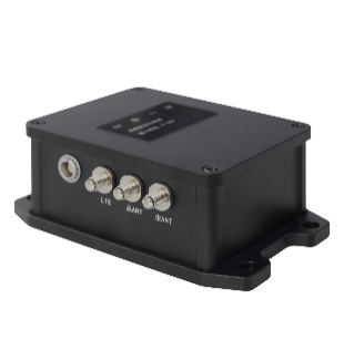
S10 High-Precision Positioning Terminal
Full-band, full-constellation RTK positioning and orientation terminal with built-in high-performance IMU for high-precision vehicle navigation and surveying.
Core Features
- Full-band, multi-constellation RTK centimeter-level positioning and orientation
- BDS/GPS/GLONASS full-band intelligent fusion
- Built-in high-performance IMU inertial navigation system
- 4G-CAT1 Wireless Communication
- LEMO coaxial connectors ensure stable transmission.
- Adaptive Installation Angle Algorithm
Technical Specifications
- Positioning accuracy: RTK horizontal 0.8cm+1ppm, vertical 1.5cm+1ppm
- Heading accuracy: 0.1 degrees/1m baseline
- Inertial navigation position estimation accuracy: 8‰ × distance traveled
- Inertial navigation dead reckoning accuracy: ≤0.5° (over 60s)
- Operating temperature: -35°C to +70°C
- Dimensions: 128×79×50mm
- Weight: 435g
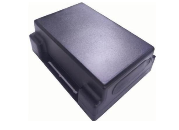
TK6 Location Tag
Indoor-outdoor hybrid multi-assist positioning tag supporting Bluetooth/WiFi indoor positioning, designed for warehousing, logistics, and asset management.
Core Features
- Outdoor BDS+GPS+Galileo+GLONASS+QZSS Combined Differential Positioning
- Indoor Bluetooth Positioning Fusion (BLE5.1)
- WiFi scan-based positioning fusion
- 4G-CAT1 Global Network
- 6000mAh Large-capacity battery for all-day power
- Supports JT808 dual-position reporting protocol
Technical Specifications
- Positioning accuracy: Single-point 3-10m CEP, RTK 10cm+1ppm
- Indoor Bluetooth positioning accuracy: 3~5m
- WiFi Positioning Accuracy: 5~10m
- Battery Capacity: 6000mAh
- Charging method: Type-C DC5V@1A
- Operating Temperature: -20°C ~ 70°C
- Water Resistance Rating: IP66
- Size: 95.0×73.0×44.0mm
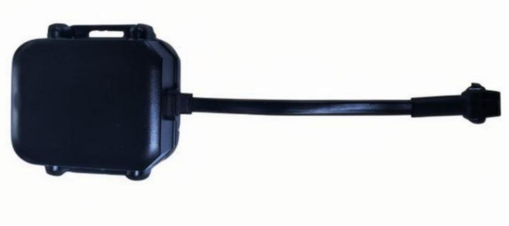
GT03 Vehicle Tracking Terminal
Industrial-grade 4G global network vehicle GPS tracker, supporting 9-90V wide voltage input for construction and commercial vehicles.
Core Features
- Supports multi-mode positioning with BDS, GPS, Galileo, GLONASS, and QZSS
- High-Precision RTK Centimeter-Level Positioning (Optional)
- 4G-CAT1 Global Network
- Supports wide voltage input from 9 to 90V
- Built-in 3-axis accelerometer with intelligent algorithms
- Supports voltage detection and ACC detection
- Remote fuel/power cutoff (optional)
Technical Specifications
- Operating Voltage: DC 9V~90V
- Operating Current: 12V / Average 80mA
- Positioning accuracy: Single-point 3-10m CEP, RTK < 10cm+1ppm
- Cold start time: average ≤ 30s
- Size: 70.00×69.20×25.40mm
- Operating Temperature: -20°C ~ 65°C
- Water Resistance Rating: IP67
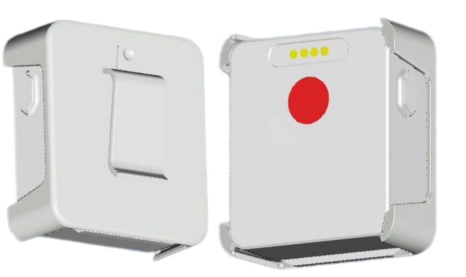
TK02 BeiDou Positioning Terminal
4G CAT1 Multi-Network Beidou Positioning Terminal, supporting GPS/BDS/Galileo/GLONASS multi-mode positioning, IP68 waterproof rating, and one-touch SOS alert. Ideal for personnel safety management scenarios.
Core Features
- Supports multi-mode satellite positioning: GPS, BDS, Galileo, GLONASS
- 4G-CAT1 Global Network Communication
- SOS One-Tap Emergency Call
- G-sensor
- Magnetic charging
- IP8 Water Resistance Rating
Technical Specifications
- Positioning accuracy: single-point horizontal 1.5m CEP
- Operating current: ≤55~60 mA
- Standby current: ≤1mA
- Battery Capacity: 1200mAh
- Charging requirement: DC5V@1A
- Operating Temperature: -20°C ~ 70°C
- Overall Dimensions: 48.5 × 42 × 16 mm
- Weight: Approximately 33g (including mounting clip)
- Housing Material: PC+ABS V0 Flame-Retardant
Work Mode
- Real-time Mode: 15 seconds per location fix; battery life 12-14 hours
- Smart Motion: Reports 5 times every 1 minutes during activity, and 1 times every 1 hours when idle.
- Periodic Task: Report at configured intervals
Get Product Solution
Our technical experts will recommend the best product solution tailored to your specific needs.
Consult a technical expert